SERVICES
Pointcloud to Revit Surveys
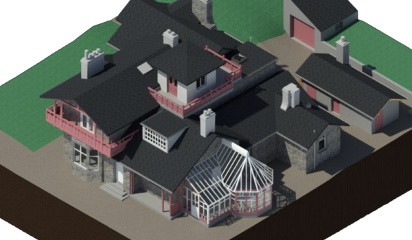
We provide accurate Revit models derived from survey data, captured using a laser scan point cloud. We are one of the few measured survey companies in the UK who are competent to produce Revit models. Our prices are transparent and highly competitive.

At Archilink, we have refined the process of collecting data and generating an accurate revit models:
- Capture the pointcloud: We use a Lieca 3D scanner to capture a pointcloud of the physical environment that we want to model in Revit.
- Clean up & Convert: Once the data is captured on site - this is put through series of different programs that refines the data and compatible with Revit.
- Setup: We import the pointcloud into Revit, setup coordinates systems & import the architect's project standards.
- Model: Once the pointcloud is imported into Revit, we then begin to create geometry that matches the pointcloud.

Overall, the process of getting a point cloud into a Revit model involves capturing the point cloud, cleaning it up, converting it to a format that Revit can read, importing it into Revit, setting up project coordinates, modeling using the point cloud, and verifying accuracy.