WE ARE THE
SURVEY & DIGITISATION SPECIALISTS
TRUSTED BY UK'S
FINEST ARCHITECTURE
PRACTICES
Trusted Surveyor for more than 275 Architecture Practices
1200+ Buildings scanned every year
3 Revit models completed daily across four UK locations
Over 45 Billion data points collected every day
Since 2018, 4500+ projects completed

DISCOVER ARCHILINK
OUR LOCATIONS
CLIENT TESTIMONIALS
FEATURED PROJECTS
AT A GLANCE
10 -12 Day
Turnaround
We prioritise efficiency as it enables us to deliver timely and accurate results, ensuring client satisfaction.
Survey
UK Wide
We deliver reliable survey services from our four UK locations: Aberdeen, Glasgow, Manchester and London.
Measure Under
An Hour
Residential properties are often measured by our team in under an hour.
Works For
Everyone
We can tailor the survey delivery to fit your practice.
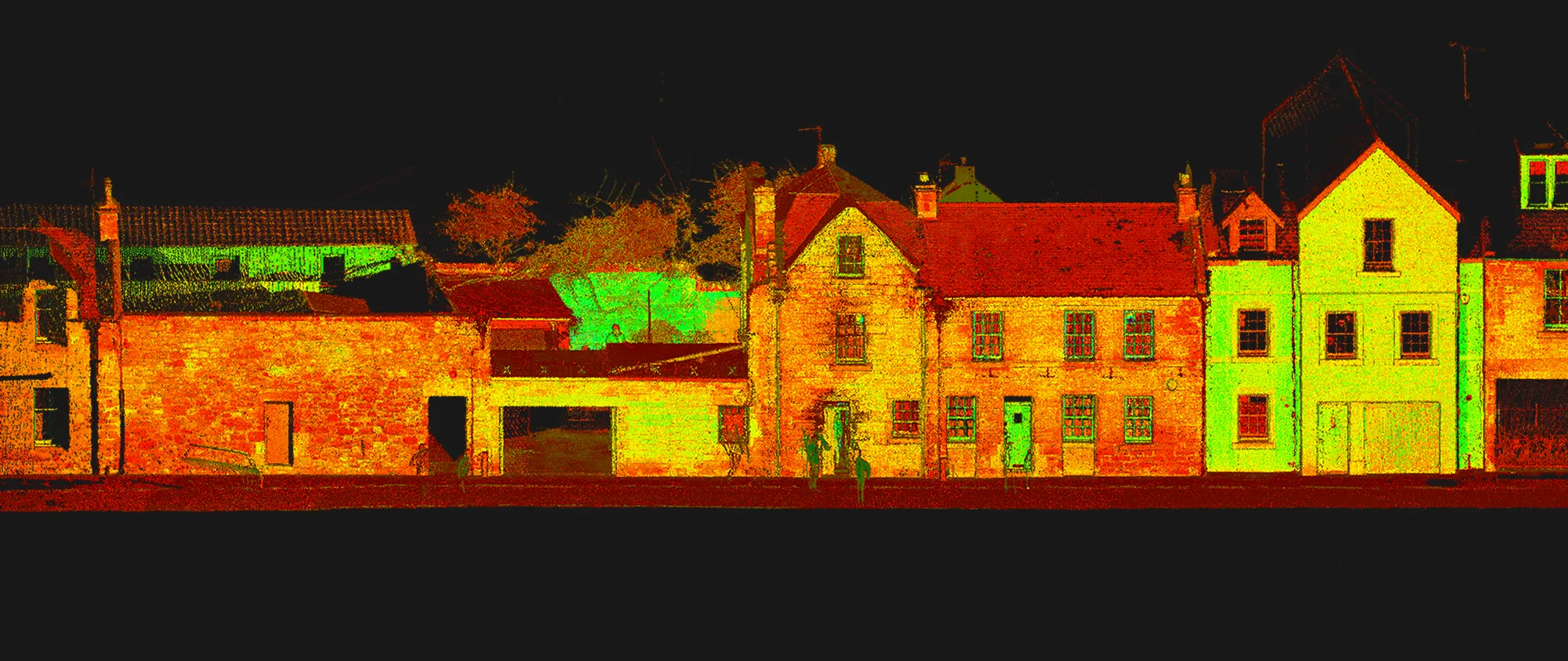
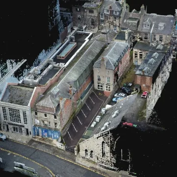
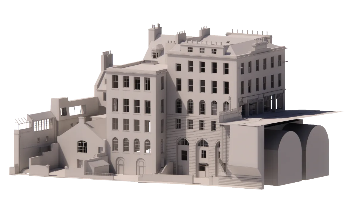
Use your mouse or trackpad to
manipulate the 3D model below
EXPLORE THE
POWER OF
POINT CLOUD
WORKING 3D FILES
DELIVERED STRAIGHT
TO YOUR INBOX
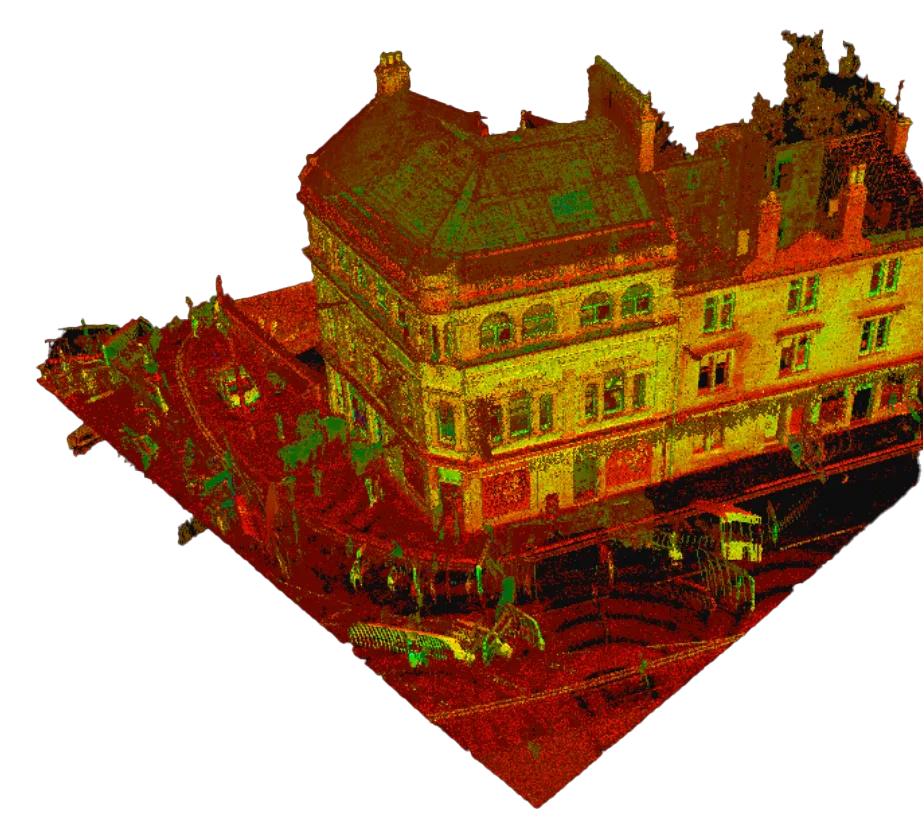
Our rapid scan technologies
don’t compromise on quality - recording your site with speed and accuracy depicting the
real-world environment in minute and near perfect detail.

AS SEEN ON
BOOK A
SURVEY
Get in touch today to discuss your upcoming projects - and let us help realise your new survey workflow.